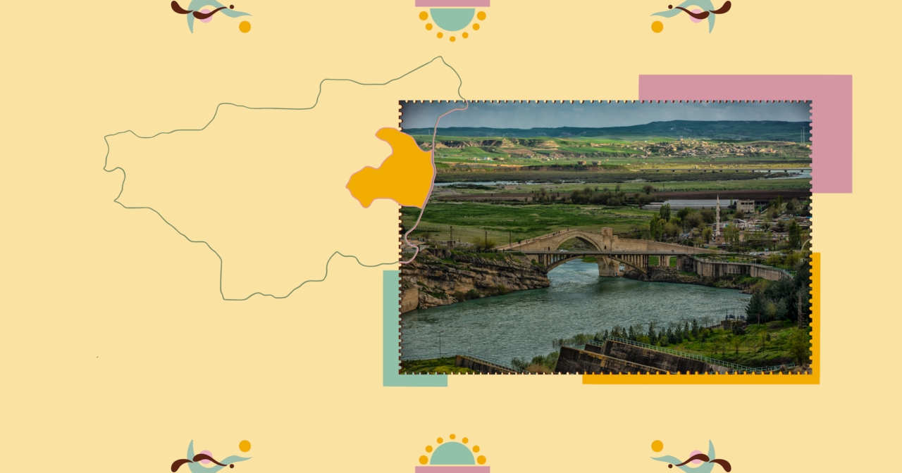
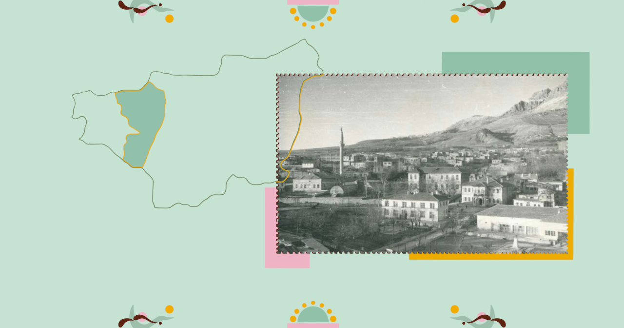
Ergani is an ancient settlement, at a distance of 90 kms to Elazığ and 60 kms to Diyarbakır, founded on the highway that connects the two cities today. Besides by road, it is possible to travel to the district by rail as well. Departing from Elazığ or Diyarbakır, the first sight that catches the eye is Makam Mountain (Zülküf Mountain / Çiyayê Meryema), to the north of the district.
Müslüm Üzülmez, a writer and researcher from Ergani, tells the story of his own lands, both from a distance, looking at the district from high, and also with a discourse that speaks from the very heart of the region.
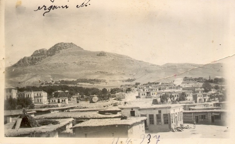
The best way to get to know this ancient town is to climb atop Makam Mountain – at 5 kms distance to Ergani centre, its peaks appear as twins holding hands – and sit on the rocks beside the Virgin Mary Church that stands derelict at the summit. Another option would be to descend a little, and enjoy a bird’s eye view of Ergani from atop Kuşkayası. First, however, let’s get to know the historical Ergani Fortress on the mountain summit, and the two holy sites, the seat of the Prophet Zülküf, or Dhu al-Kifl, and the Virgin Mary Church.
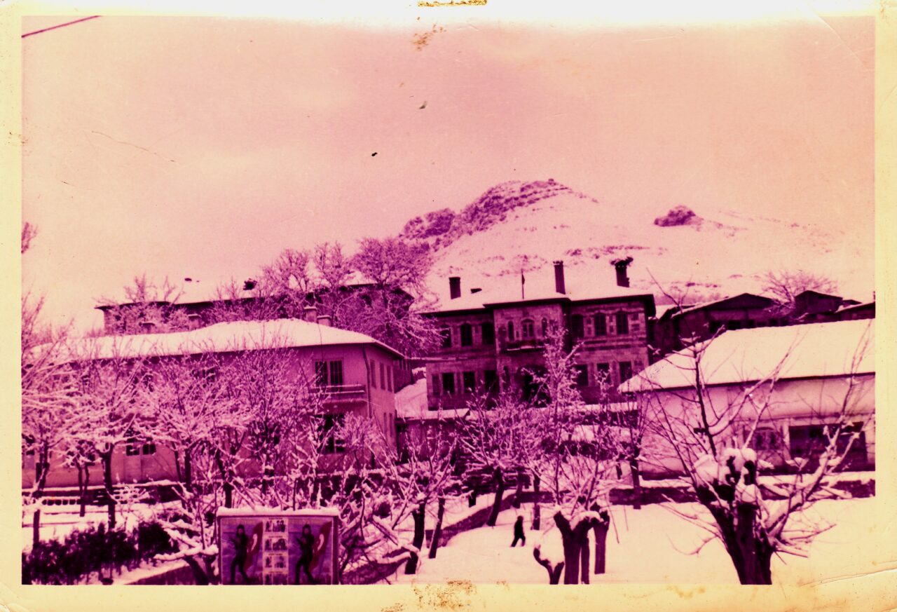
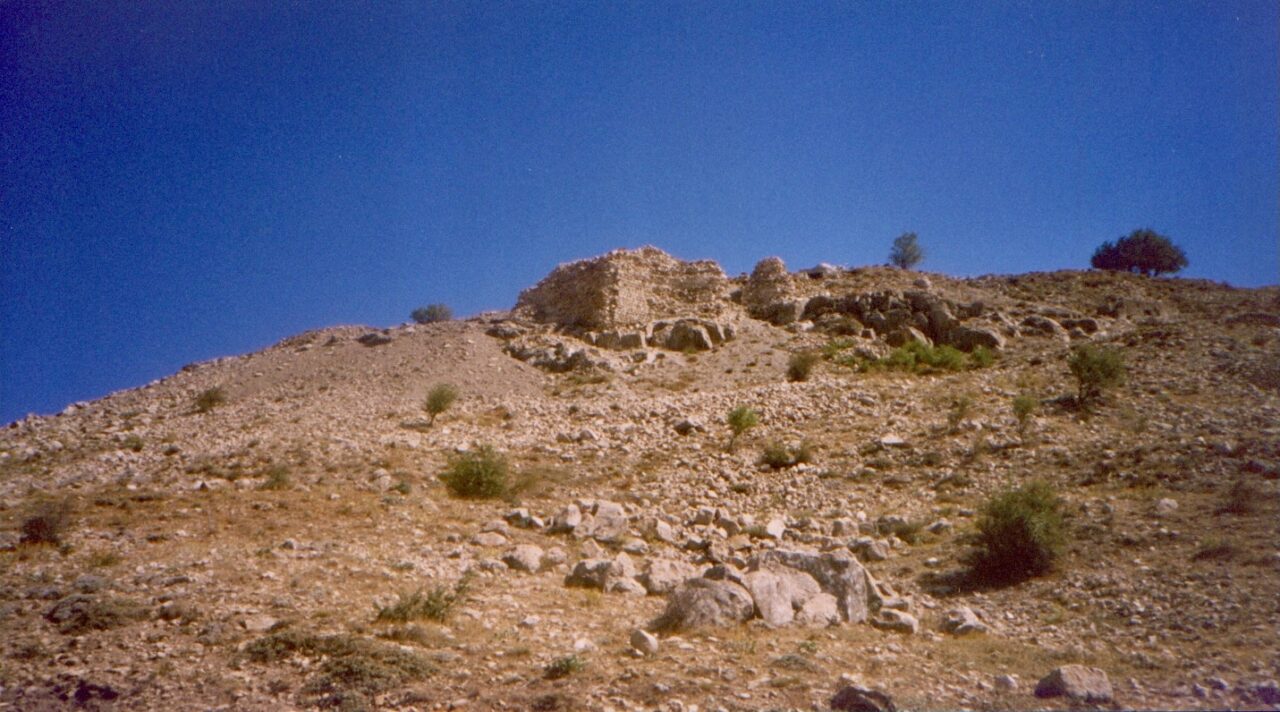
Back in the day, the old town of Ergani was made up of two parts, the lower and upper city, and the town was founded on the upper part of Zukar Effendi’s Garden, or in other words, of Karaçortan, and extended as far as Ergani Fortress in the north. Resisting time, drifting like the wind on the summit of the mountain, Ergani Fortress continues to persistently witness the past today.
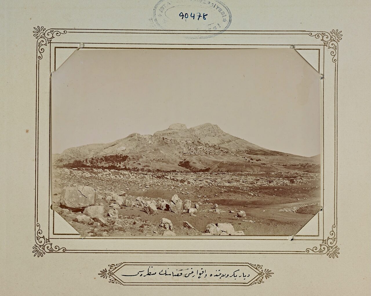
Matthew of Edessa, in his Chronicle, records the events in the region from 952 to 1136. Here, he relates in highly dramatic discourse, how Prince Harpik lost his life during a siege on Ergani [Arkina] Fortress. The death of Prince Harpik is both an interesting event, and closely concerns the history of Ergani.
During that period, Armenian lords commanded Ergani Fortress, they switched from time to time between paying homage to the Caliph of Islam and Byzantine Emperor, and sent troops during periods of war. Since they were positioned between two great military powers, these Armenian lords fought at times against the Seljuk, and at other times against the Byzantine. The Byzantine Emperor Constantine IX Monomachos sent a powerful army to the region in order to tie all local Armenian kingdoms, and first and foremost the Ani Armenian Kingdom, to himself, and laid siege on Ergani Fortress. It was during this siege that Prince Harpik was murdered by deceit.
In his famous Seyahatname [‘Book of Travel’] Evliya Çelebi states that Ergani Fortress was built on the orders of the Abbasid Evhadullahzâde Ergani Sultan, and that the people of the town falsely referred to the city as Argini, and that the fortress had later been conquered by many other sovereigns. He also mentions the famous grapes and must of Ergani.
Ghougas Indjidjian, the Armenian geographer and priest, in his work titled The Geography of the World, writes, “There is a strong fortress at the top of the mountain. It was built in ancient times. Muslims (Daciks) live inside it. Now, this fortress has been completely abandoned, but it is occasionally used as a prison. The people living in the fortress are exempt of taxes, however they are, from time to time, responsible of the care of prisoners there”.
This is what Şevket Beysanoğlu wrote about Ergani Fortress:
“We were unable to find any other document on the restoration of Ergani Fortress in the year 805 according to the Islamic calendar (1402-1403 according to the Gregorian Calendar) by Karayülük Osman Bey. Ergani is the first fortress conquered by the Aq Qoyunlu. It was sieged many times, and battles took place before it. It was perhaps renovated a few times during the Aq Qoyunlu period. However, we have so far been unable to access documents that confirm this. In research we conducted on site, we came across inscribed stones used in walls surrounding Zülküfül Makamı. These stones, perhaps, belong to the walls of the fortress. The stones were in pieces and dispersed, so it was impossible to reach any meaningful conclusion.”
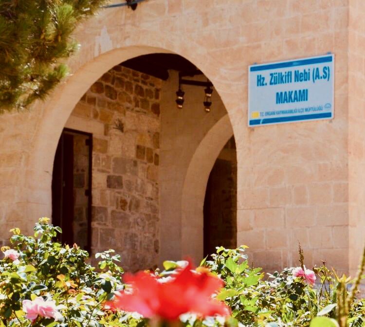
It is said that the tomb of Prophet Dhu al-Kifl is in Eğil, and his seat is in Ergani. However, many believe that his tomb is also in Ergani. It is not clear when Prophet Dhu al-Kifl’s seat was constructed, however, it is known that it was demolished in 1926 on the orders of the First General Inspectorate. Later, in 1958, the Ergani Charitable Society built a new stone building for the seat.
At this new building/masjid, we first see a courtyard painted in turbe green, and three sections inside.¹ At the front section, there is a prayer section for men, and in the lower section accessed through a door, a prayer section for women. Through the middle section, one can access the tomb. Although it is said that Prophet Dhu al-Kifl lies here in the tomb covered by a green cloth, one should not believe this. There are also those who claim that it is Abdullah, an acolyte of Prophet Dhu al-Kifl, who lies here.
¹ According to the author’s latest visit in 2004.
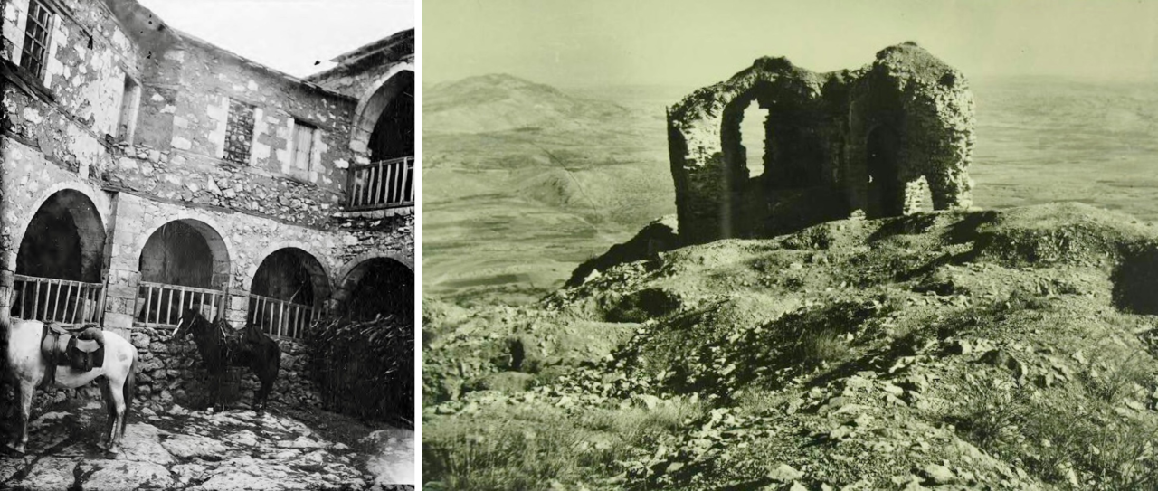
The second photograph of the church is from the Şevket Beysanoğlu Collection. (DKVD Diyarbakır City Archive)
The Virgin Mary Church (Surp Asdvadzadzin / Dêra Meryemayê), atop the large rock overseeing the Tigris River and to the east of the summit of Zülküf Mountain, is a symbol of Ergani, like the seat of Prophet Dhu al-Kifl. It is perhaps because of the name of this church that the other name of Zülküf Mountain is Çiyayê Meryema.
Although it is not known when the church was built, some sources state that it was designed and constructed in 1434 by Mgrdich Nakashian of Bitlis under the name Partsrahayyats Virgin Mary Monastery. The most detailed information we have on the church are from Ghougas Indjidjian’s work titled The Geography of the World.
The black and white photograph accompanying the text belongs to Gertrude Bell, the English writer. Bell describes her arrival in Ergani in 1909 in the chapter titled “Diyârbekr to Konia” in her book titled Amurath to Amurath:
“Outside the village of Tarmur¹ we spent the night somewhat uneasily by reason of certain wedding festivities which were there in progress. (…) Peace was restored by daybreak, and the marriage procession conveying the bride to her husband’s house set off to the strains of fife and drum. (…) …and rode on to the hill of Arghana… (…) …and thence by a steep path to the Armenian monastery of the Virgin, which stands on the summit of the rocks.
We were rewarded by a magnificent view and a pleasant talk with the prior who informed me, as I drank his excellent coffee, that the monastery was founded in the first century of the Christian era, a tradition which calls for weightier confirmation than any which he advanced. Be that as it may, the existing house must have been largely rebuilt in the Middle Ages, perhaps towards the fourteenth century (…)”
¹ This must be the Termül/Aşağıkuyulu village of Ergani, close to Geyik Station, 200 metres north of the Diyarbakır-Elazığ highway.

We must also mention the Makam flower, unique to Makam Mountain, and then also the Makam nightingale. The Makam flower can be found especially in stony and rock areas extending from the Aşağı Suluk and Çırçırik areas to the masjid, and legend has it that it grows where the Prophet Dhu al-Kifl’s drops of sweat hit the ground. According to another legend, it was the drops of sweat of Caliph Ali’s horse, and since that day, it can only be seen at Ali Mountain and Makam Mountain. There are other legends on the origin of this flower, too.
The Makam flower is a charming flower of the family Liliaceae, which generally blossoms in late April and early May. It has a straight stem, reaches a length of 15-20 cm, and is an elegant wild plant which comes into purple flowers shaped like a funnel among its thin green long leaves. Both because it is believed to be holy, and because of its beautiful odour, it is also dried for keeping in homes.
Another beautiful aspect of Makam Mountain are the rock nightingales that sing songs full of love. These tiny birds who display the same tinge with rocks, never seem to fall silent. For me, the reason for that is the absence of roses in these holy lands, on this mountain and along the skirts of this mountain.
Now, on the rock we are perched, we can turn towards the south, towards Karacadağ, to look at Ergani.
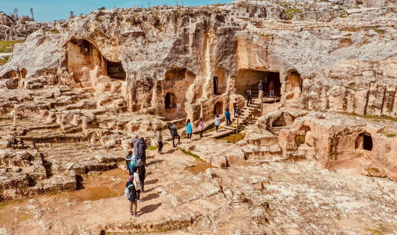
At first sight, we see the plains of Hani Gevran / Xana Gewran and Hüşot/Xûşot/Aşot, extending as far as the skirts of Karacadağ Mountain. The beginning of the Hüşot Plain is home to the Hilar caves, a symbol of Ergani, and also Çayönü / Qotê Ber Çem, the former Dicle Village Institute which is now the Anadolu Teacher Training High School and the Ergani Railway Station.
The Hilar caves are at a distance of approximately 7 km to the district, to the south of Ergani and the east of Hilar village. Rocks appear to form a natural, crescent-like fortress around the village. The first rays of the sun hit these rocks in the morning and slowly spread across the plain across their skirts. This caressing, pleasing morning light creates the impression that a temple still surviving in the Hilar rocks has come to life. Many historical monuments that remain extant are located at this strait at the entrance of the village. Hilar used to be a village of Ergani. When the boundaries of the metropolitan municipality were extended it became a neighbourhood. Its name in official records is Sesverenpınar.
In his Chronicle, Mateos of Edessa writes that from 13 March 1035 to 11 March 1036, the Muslims and Christians fought a bloody battle, and that the Muslims committed a massacre in Sevaveragk and Alar. In a footnote to the book, French historian Édouard Dulaurier states that Sevaveragk was a city in Armenian Mesopotamia, that its current name is Siverek, and that Alar was probably a settlement close to Siverek. Historian Prof. Dr. M. Halil Yinanç, in the same footnote, writes that this site was referred to as Hilar in the works of Muslim geographers and that it was one of the fortresses of the Diyarbakır area. Departing from this information, we can state the following: In the years 1035-1036, the Armenians called the town Alar, while Muslims referred to it as Hilar.
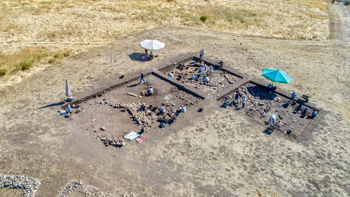
Archaeological studies reveal that Hilar is an ancient settlement and worship site. Hilar is today the common name of the village/neighbourhood that comprises the rocks, caves and Çayönü. Çayönü is a hill of Hilar, and the archaeological excavation there has made a mark in world cultural history, however, Hilar itself, its caves and reliefs have been overshadowed by Çayönü.
Anthropologist Prof. Dr. Metin Özbek offers a beautiful description of the people of Çayönü:
“They were a handful of people. They came, and approximately 11 thousand years ago, decided to live on the plains of Ergani, in an area close to water resources. At first, they had no knowledge of agriculture and husbandry. They hunted the wild animals in their environment, and sustained their lives by gathering wild plants. Over time, they learned how to farm. This enabled them to make a return of three for one in agriculture. They now had surplus product, and they laid the foundations of a village community based on food production. They had domestic animals like sheep, goats and pigs. In time, cattle were added to these. They began to live closely with them. This new economy of living added new dimensions to their social structures. They enriched their village that rested on the Hilar rocks with the most complex structures of the period, which featured different functions. Beside their homes that reflected quite a plain architectural style, they built majestic monumental structures.”
More knowledge came to light about Çayönü with the Joint Prehistoric Research Project in Southeastern Anatolia.¹ Before that, archaeologist Prof. Dr. Kılıç Kökten had begun work in Ergani in 1946 on behalf of the Turkish Historical Society, and had come across findings that revealed that there was life in the region even before the Çayönü settlement. Flintstone remains from the Middle Palaeolithic Age were found in the plain between Geyik Railway Station and Hilar Village.
¹ Excavation work led by archaeologist Prof. Dr. Mehmet Özdoğan from 1991 to 1993, held in the Tilhuzur (Yayvantepe) village in close proximity to Çayönü, also increased our knowledge on Çayönü.

The second photograph shows Halet Çambel and Linda S. Braidwood at the Excavation House at the Ergani Teacher Training School. (Çayönü Excavation Archive)
The Joint Prehistoric Research Project in Southeastern Anatolia began in 1962 with the joint initiative of the Istanbul and Chicago universities and under the leadership of Prof. Dr. Halet Çambel and Prof. Dr. Robert J. Braidwood. The aim was to carry out archaeological research on the transition stage to productivity and on the emergence of the first agrarian village communities in the Upper Tigris Basin, of which there was no knowledge at all. This comprehensive project that continued with the participation of many local and foreign scientific institutions achieved interesting results.
In the report on the 1988 Diyarbakır Surface Survey, Mehmet Özdoğan states that the intensity of Neolithic Period cities in the area that includes Çayönü is a rare occurrence in the Near East.
The 1988 Çayönü Excavations report prepared collectively by Halet Çambel, Robert J. Braidwood, Mehmet Özdoğan and Wulf Schirmer, emphasized that Çayönü was the excavation site that provided the most reliable information when compared to other, contemporary settlements in the Near East. Along with Nevalı Çori and Hallan Çemi, Çayönü is one of the earliest representatives of the Neolithic Period, and a period village that best reflects the transition from an economy based on hunter-gathering to a sedentary way of life.
Although founded after the passing of Atatürk, the Village Institutes were, in fact, a developed version of the Village Teacher Training Schools, that were established in his lifetime. The aim of the institutes was to train the villagers, perceived as an untrained and unqualified workforce, and send them back to their villages, in other words, to enlighten and develop villagers with resources from the village itself. This meant that capable, intellectual teachers whose philosophy of life centred around collective production and consumption were trained.
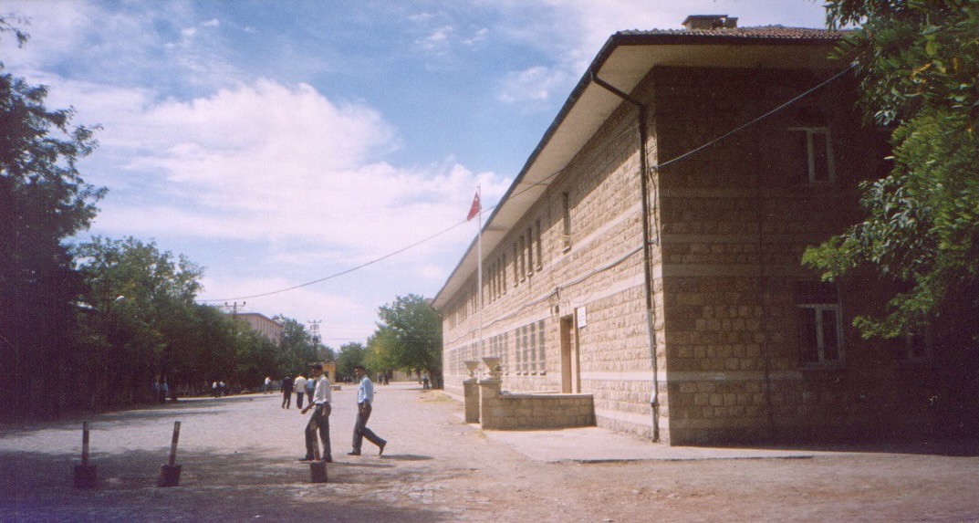
The Dicle [Tigris] Village Institute was founded in 1944, between the railway station and Hilar village, 5 kms south of the Ergani district centre. With around 2 thousands donum of agricultural land, it was a fully-equipped school. The first school principal, Nazif Evren, made great contributions during the period of foundation and the first period of education. Many intellectuals, writers, painters and musicians such as Enver Atılgan, Kemal Burkay, Osman Şahin, Adnan Binyazar, Mahmut Baksi and Fehmi Salık graduated from the Dicle Village Institute.
In 1954, first, the name of the Village Institutes was changed to Primary School Teacher Training Schools, then they became Teacher Training High Schools, and the institutions increasingly deviated from their initial aim. The Dicle Village Institute was also affected by this process. Yet this school had also hosted archaeological work carried out in Çayönü. The Çayönü Excavation House remains active today.
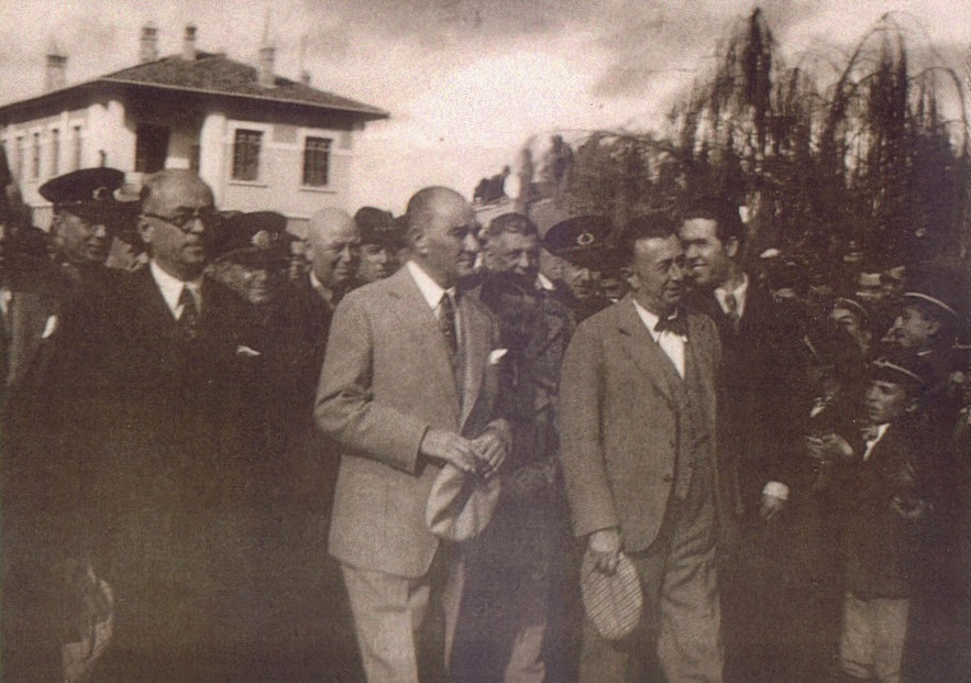
It is necessary to understand that transport, and especially the railway, was an important condition for the development of capitalism, and that it was one of the vehicles of the imperialist seizure of land. The Baghdad Railway was a site of great competition between the British and German versions of imperialism. The railway service began to operate in Diyarbakır on 23 November 1935. On 16 November 1937, Atatürk led the groundbreaking ceremony of the Diyarbakır-İran-Irak railway line. My father’s paternal uncle, Zekeriya Üzülmez, and his Armenian master Xaço Usta, contributed to the construction of the Diyarbakır-Ergani-Elazığ-Pertek railway line that was within the scope of this project. These two construction masters worked in the construction of tunnels and bridges. My Zekeriya Uncle used to tell us how Xaço Usta used to work selflessly on the construction of the bridges across the Euphrates and Tigris and their tributaries, each one considered a historical monument today, and the dark tunnels passing through the mountains.
With the opening of Ergani Railway Station, a ceremony was also held, and Atatürk came to Ergani on 15 November 1937. Witness accounts relate the events of the day as follows: Atatürk slowly appeared in [the window of] a compartment coach. Primary school children, prepared beforehand at the station, read poems. Atatürk made a very short speech because of his illness, and greeted the students. When the train whistle hooted and the pistons moved, Atatürk put his head out of his wagon, waved to the crowd and the train continued on its way to Diyarbakır. Şevket Beysanoğlu, in his recollection of that day, underlines the scale of the enthusiasm, but adds that Atatürk’s stop lasted only five minutes.
![Kör Zülfo [‘Blind Zülfo’] had spent forty years playing his <em>kaval</em> at Ergani Railway Station, sending off and meeting a few generations while doing so. To use his real name, Zülfi Yokuş’s kaval is now exhibited at Diyarbakır City Museum. (Photograph of Hafız Zülfo: Mahmut Yüceli, 1993 / Photograph of his kaval: Diyarbakır City Museum Archive)](https://diyarbakirhafizasi.org/wp-content/uploads/2023/12/12_Ergani-1280x427.png)
Speaking of Ergani Railway Station, one has to mention Hafız Zülfo. When he played his kaval at the station, its sound would touch hearts when it combined with the sound of the train and screams of sadness and happiness of people around. From 1940 to 1980, in other words, for 40 years, everyone who passed through Ergani Railway Station listened to his kaval. His kaval, too, fell silent, when he passed away, and the railway station was orphaned. According to the accounts of good people, at daybreak at the summits of Zülküf Mountain and Karacadağ, the sound of the wind is still accompanied sometimes by the sound of Hafız’s kaval.
The instrument of this visually impaired master was also made by another disabled artist, the Armenian carpenter Nışo, bringing together two master artists of the two ancient peoples of these ancient lands through their skills. Known as Kör Zülfo [‘Blind Zülfo’], Hafız’s real name was Zülfi Yokuş, he was a Kurd from Diyarbakır. Known as Topal Nışo [‘Lame Nışo’], the real name of Nışo, an Armenian from Diyarbakır, was Dikran Nışan. In his work titled Gâvur Mahallesi [‘Giaour Neighbourhood’] Mıgırdiç Margosyan mentions Nışo and writes that he made kavals from plum tree wood.
The kaval made by Nışo, and blown into for so many years by Hafız is today exhibited at the Diyarbakır City Museum. In the exhibition hall, to one side of the kaval, there is my brother Miktat Üzülmez’s poem about Hafız, titled “Ben Seni Beklerken [‘As I Wait for You’], and on the other side, Mehemed Malmîsanij’s poem in Zazaki titled “Lulbendo Erxeniyıj” (“The Kaval Player from Ergani”), both framed.

We sat on a rock when we started to tour Ergani. When we look east from that rock, we see the beautiful bluish waters of Kralkızı Dam. The Bağin Village, frequently referred to in history books, was located to the east of the dam. Şerafettin Güneli, a writer from Ergani, writes that the entire population of this village was Christian, and that in 1915, the village was emptied, and that the empty houses were demolished. The ruins on which the village was founded date even further back. Güneli states that, although they were affiliated with the Armenian Church, the Christians here did not speak Armenian but Zazaki, and adds: “The Bağin Village is to the east of the Kralkızı Dam, constructed on the Tigris River. Its remains are partially submerged by the dam reservoir. It appears that many Kurds were called Armenians because they attended the Armenian Church.”
When we keep looking in the easterly direction, we see the Ergani-Dicle/Pîran highway to the south of Kralkızı Dam. The Hafselm (Bademli) village is an ancient settlement placed on the eastern slope of the Kıleş/Qileş Mountains, and at a distance of 15 kms to Ergani. The Hafselm caves, opposite Hafselm village, in other words, to the south of the Ergani-Dicle highway, used to be an Armenian settlement. Şerafettin Güneli, too, wrote, “The people of Hafselm village were Christian, too. They were affiliated with the Armenian Church, yet they did not speak Armenian. They spoke the Kurmanji dialect”.
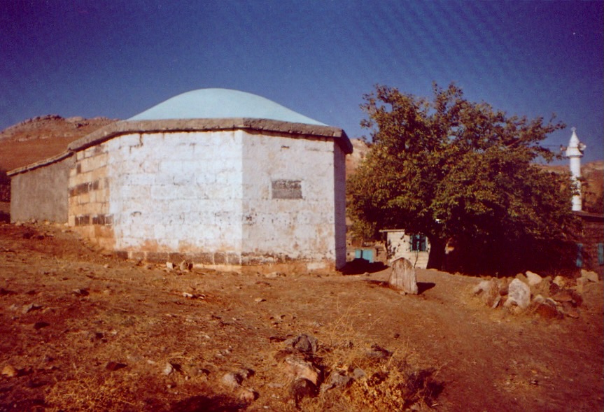
When we turn west from the rock we are sitting on, we see a turbe on the southern slope of Prophet Enüş Mountain, 12-13 kms to the southwest of Ergani, in the village of Otluca, or to use its better known name, Kızılca. One has to follow the route through Ergani-Yolköprü/Kalxana-Ortayazı/Aşağı Balahur-Kızılca to arrive at this turbe. Some say it is the Prophet Enüş, others argue that it is the Prophet Abbas who is buried here. Some others say that the prophets Enüş and Abbas were the same person.
Constructed in the form of a cupola, the turbe is an old structure built with lime boil. It is said that five names can be read on some stones: İbn-i Enüş, İbn-i Şit, İbn-i Kinan, Yerd Bin-i Mehlail and İbn-i Adem. There are many legends about the turbe. For instance, Şerafettin Güneli states that if the inscriptions on the stones are true, the sixth generation grandson of Adam, his Holiness Yerd lies here.
Şehmus Aslan, a researcher from Ergani, departs from the account that claims that Prophet Enüş was the brother of Prophet Dhu al-Kifl, and writes, “He was Prophet Şit’s son, and the grandson of Adam. He was a person with deep knowledge of astronomy. He lived for 960 years. That is also why the triangle formed by Hilar, Kızılca and Kikan is considered the first settlement in the history of the world. In other worlds, genesis took place here, and people spread across earth from this point”.
The turbe accepts visitors on Friday daytime and evenings. As in the seat of the Prophet Dhu al-Kifl, prayers are said and wishes are made. However, for some reason, there are never as many visitors to the Prophet Enüş/Abbas as there are for the Prophet Dhu al-Kifl. There is a sense of neglect and forlornness at the turbe.
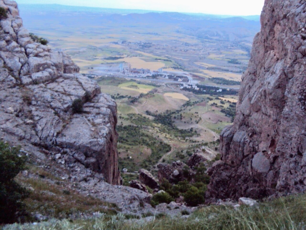
Planning for the Southeastern Anatolia Project (GAP) began in the 1970s, and its program comprising mostly a series of dams and hydroelectric power plants, was promoted around the target of developing the area. The Ergani Cement Factory, too, was founded in 1976 as part of this targeted economic acceleration and production began in 1984. In the 1990s, as privatization picked up speed, the Ergani Cement Factory, which held a considerable market share at the time, was sold to the Uzan Group in 1997. In later years, the factory was transferred to the Savings Deposit Insurance Fund (TMSF) and following a new tender held in 2005, its new owner became the Limak Cement Group.
Although the Ergani Cement Factory did provide various employment opportunities throughout the years, the damage it has caused to Ergani has been great. When the filters of the factory chimneys are not operated, or are out of order, Ergani is covered in dust, and both the young and the old are forced to breathe in this dust. Unfortunately, agricultural land is also gravely affected by this dust.
![Since the town of Ergani was moved and rebuilt on a different site, it was also distanced from its history. Today, the oldest structures in the district centre are Cami-i Kebir [‘The Large Mosque’] and the former district governorate building. (Photographs: Müslüm Üzülmez, 2003)](https://diyarbakirhafizasi.org/wp-content/uploads/2023/12/16_Ergani-1280x512.png)
We have now sat at Kuşkayası for quite a long time, so it would be a good idea to take a tour of the centre. Ergani today is not in the same place as old Ergani. In the later period of the Ottoman Empire, Ergani was moved, and following the founding of the Republic, Ergani recreated itself. Therefore, there are no historical buildings in today’s Ergani. According to an inscription at its entrance, Cami-i Kebir, the oldest building here today, was built in 1921. The second oldest building in the new district centre is the old District Governorate building. This building today serves as the Sezai Karakoç Museum.
Text: Müslüm Üzülmez
Translation: Nazım Dikbaş
Cover photograph: Ergani, 1960s
BIBLIOGRAPHY
• Aslan, Ş. (1998) Mezopotamya’nın Gani Kenti Ergani [Ergani, the Abundant City of Mesopotamia], Diyarbakır: 67, 135.
• Bell, G. L. (1911) Amurath to Amurath, William Heinemann Publishing, London: 327-328.
• Beysanoğlu, Ş. (1987) Anıtlar ve Kitabeleri ile Diyarbakır Tarihi [History of Diyarbakır with its Monuments and Epitaphs], Vol. 2.
• Beysanoğlu, Ş. (1996) Anıtlar ve Kitabeleri ile Diyarbakır Tarihi [History of Diyarbakır with its Monuments and Epitaphs], Vol. 3.
• Evliya Çelebi (1985) Seyahatnâme [Book of Travel], Vol.s 3-4, (ed.) Mümin Çevik, Üçdal Neşriyat, Istanbul.
• Evren, N. (1998) Köy Enstitüleri Neydi Ne Değildi [What Were the Village Institutes?], Güldikeni Yayınları, Ankara: 82-86.
• Güneli, Ş. (1966) Bütün Yönleriyle Erğani [Erğani in All Its Aspects], Modern Matbaa, Ankara: 13.
• Güneli, Ş. (2002) “Zağros Yöresinde Değiştirilen Tarihi Yer İsimleri [Place Names Changed in the Zağros Area]”, Berfin Bahar Aylık Kültür Sanat ve Edebiyat Dergisi, 58.
• Indjidjian, G. (1808) Aşkharakrutyun Çorits Masants Aşkharhi [The Geography of Four Corners of the World], Vol. 1, Venice: 240-243.
• Margosyan, M. (1994) Gâvur Mahallesi [Giaour Neighbourhood], Aras Yayınları, Istanbul: 13.
• Özbek, M. (2004) Çayönü’nde İnsan [People in Çayönü], Arkeoloji ve Sanat Yayınları, Istanbul: 7.
• Özdoğan, M. (1990) “1988 Yılı Diyarbakır Yüzey Araştırması [1988 Diyarbakır Surface Survey]”, VII. Araştırma Sonuçları Toplantısı, Antalya, 18-23 Mayıs 1989 [VII. Research Results Meeting, Antalya, 18-23 May 1989], Kültür Bakanlığı Anıtlar ve Müzeler Genel Müdürlüğü [Ministry of Culture Monuments and Museums General Directorate], Ankara.
• Urfalı Mateos Vekayi-nâmesi (952-1136) ve Papaz Grigor’un Zeyli (1136-1162) [The Chronicle of Mateos of Edessa (952-1136) and the Addendum of Priest Grigor, (translated by) Hrand D. Andreasyan, Türk Tarih Kurumu Yayınları, Ankara, 1962: 92-93, 103.
• Yurt Ansiklopedisi Ansiklopedisi [Yurt {Homeland} Encyclopedia], Vol. 3, Anadolu Yayıncılık, Istanbul, 1982: 2228.
